US flooding on the rise in a changing climate, study shows
Robert McSweeney
02.09.15Robert McSweeney
09.02.2015 | 4:05pmThe central US is experiencing flooding more often now than it was 50 years ago, new research shows. The study across 14 states finds rivers over much of the region are breaching their banks more frequently, leading to a greater number of floods.
The researchers attribute the increase in flooding to rising temperatures in the region and more days with heavy rainfall.
Serious flooding
In recent decades, the central US has been hit by a number of serious and widespread floods. Flooding in the spring of 1993 and summer of 2008 affected as many as ten states, for example. The disaster saw hundreds of counties declared Presidential Disaster Areas, giving them access to emergency relief funding.
Scientists have since been trying to work out whether floods are getting worse or if what we’re seeing in this part of the US is down to natural variability.
To investigate changes in river flooding, scientists look at historical records of river flow and the maximum amount of water they can hold before overflowing. The flow, or ‘discharge’, of a river is measured by instruments at different points along its course.
Studies in the past have found the maximum flow through rivers hasn’t changed much over the late twentieth and early twenty-first centuries. But a new study, published in Nature Climate Change, finds that rivers are hitting these high flows more often.
More frequent peaks
The researchers analysed records of river flows from 774 instrument stations across the central US, from North Dakota to West Virginia. They counted how many times each river hit a point where there was so much water flowing through it that it was likely to cause a flood.
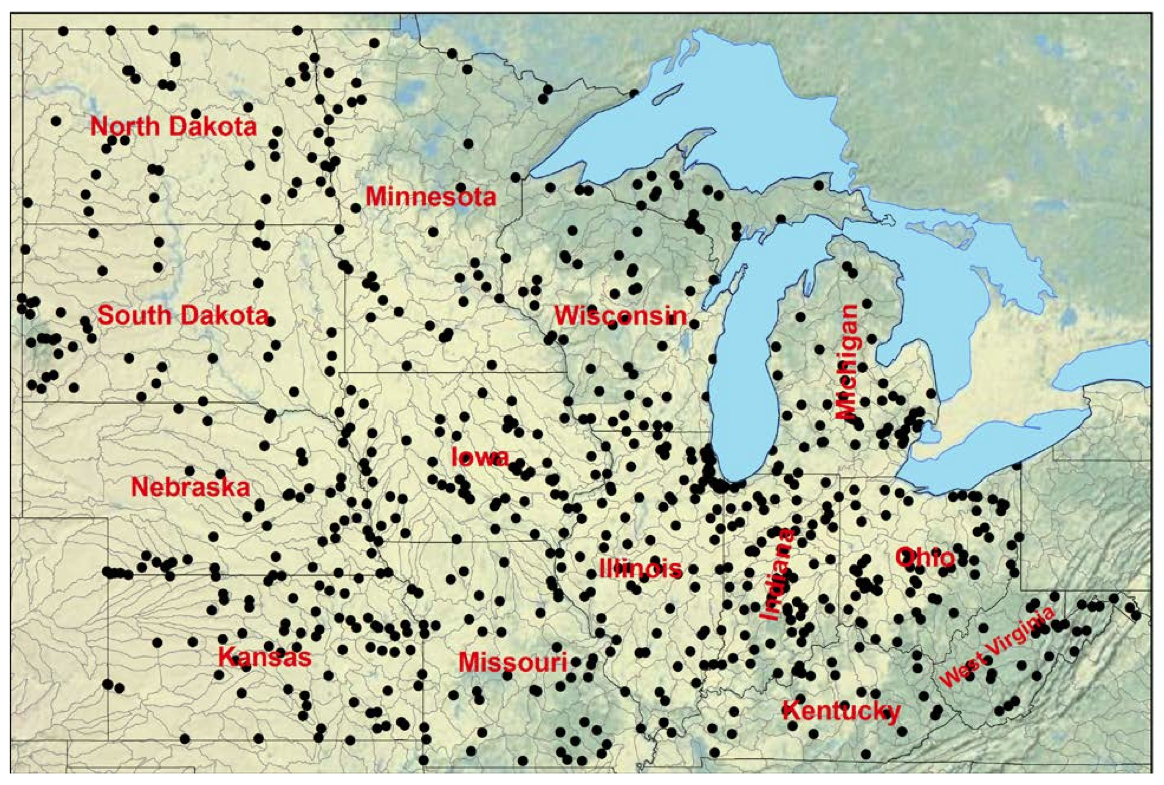
Map showing the 774 US Geological Survey stations used in this study. Source: Mallakpour & Villarini (2015)
A third of river stations (34 per cent) are passing their critical flooding thresholds more often now than they were 50 years ago, the study finds. Nine per cent of stations are seeing flooding occur less often. The results for the other stations aren’t statistically significant, which means the scientists can’t be sure the trend hasn’t happened by chance.
Across the region as a whole, the trend is towards more frequent flooding, the paper concludes:
“Overall, our analysis reveals that the largest flood peaks have not been strongly increasing in this broad belt of the central US, but, rather, the region has been experiencing a greater number of flood events.”
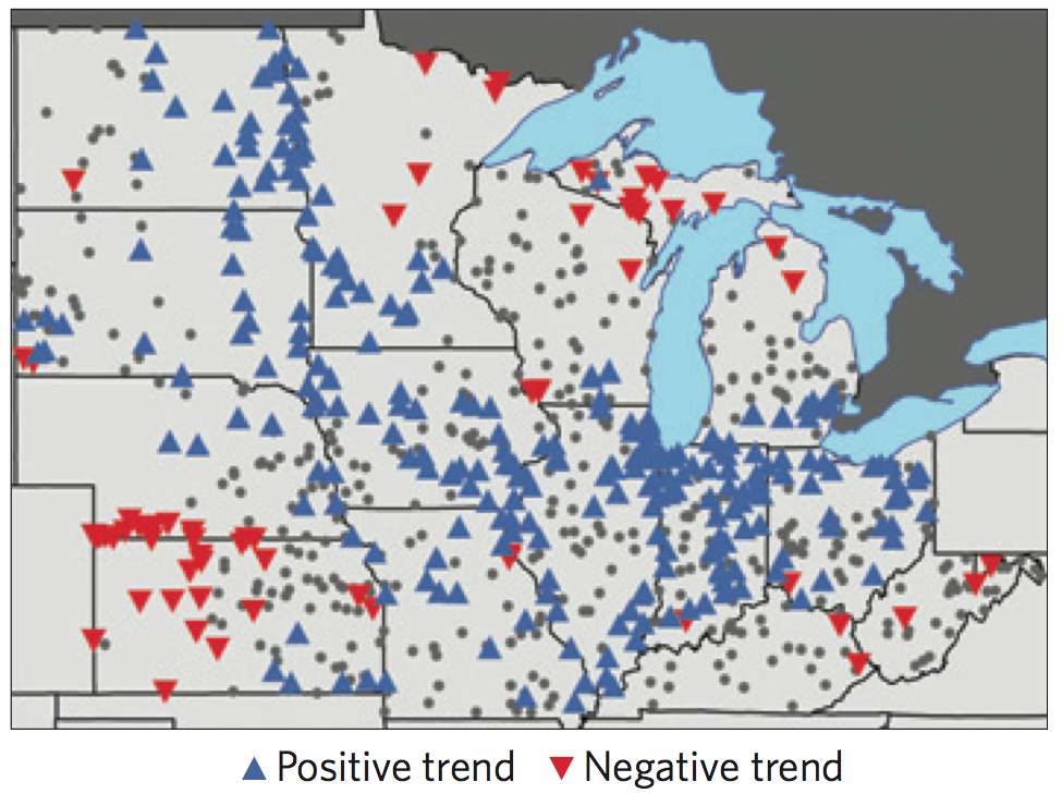
Map showing frequency of annual flooding from 1962 to 2011. Blue and red triangles show increases and decreases, respectively. Grey areas show locations that did not experience a statistically significant change. Source: Mallakpour & Villarini (2015)
The researchers found very similar results when they analysed a subset of the record, which includes 68 ‘pristine’ locations. These are stations away from urban development, reservoirs or lakes, which might affect how quickly rainwater finds its way into streams and rivers.
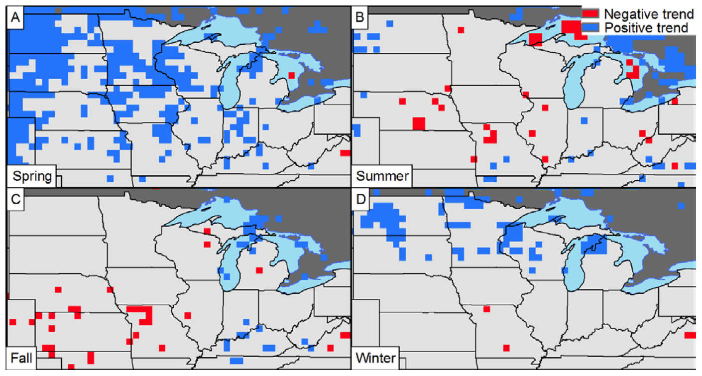
Changing rainfall patterns
What’s causing the floods to occur more often? One factor is changing rainfall patterns, the researchers say. Using the same 14 US states as before, the researchers studied how rainfall has changed over the last 50 years. The number of days with heavy rainfall has gone up over much of the region, as the blue shading in the map below shows.
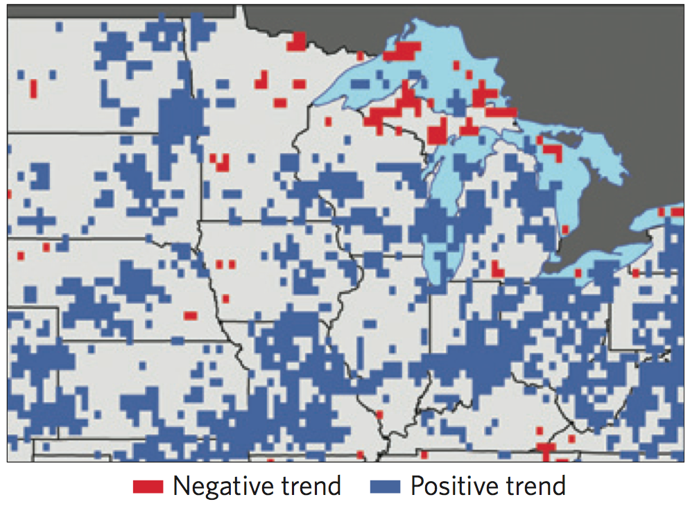
Map showing frequency of annual heavy rainfall days from 1962 to 2011. Blue and red areas show increases and decreases, respectively. Grey areas show locations that did not experience a statistically significant change. Source: Mallakpour & Villarini (2015)
Rising temperatures are also contributing to more frequent flood events, says lead author Dr Gabriele Villarini, from the University of Iowa. This is occurring as warmer springs cause more snowmelt to flow into swelling rivers. Spring temperatures have risen over much of the central US in the last 60 years, the paper explains.
Spring snowmelt is a particular problem for flooding in the northern part of the central US, Villarini says, which tends to receive more snow in the winter.
Map showing seasonal temperature from 1948 to 2011. Blue and red areas show increases and decreases, respectively. Grey areas show locations that did not experience a statistically significant change. Source: Mallakpour & Villarini (2015)
Human activity
The paper doesn’t tackle the question of whether the increase in river flooding in the central US is being caused by human activity. But an increase in heavy rainfall fits in with what scientists expect as the Earth warms up.
As temperatures rise, basic physics says this will cause an increase in moisture in the atmosphere, so when it rains, it falls in heavier bursts. A recent study found the probability of seeing an extremely wet winter like the UK did last year is 25 per cent higher than it was before humans started influencing the climate, for example.
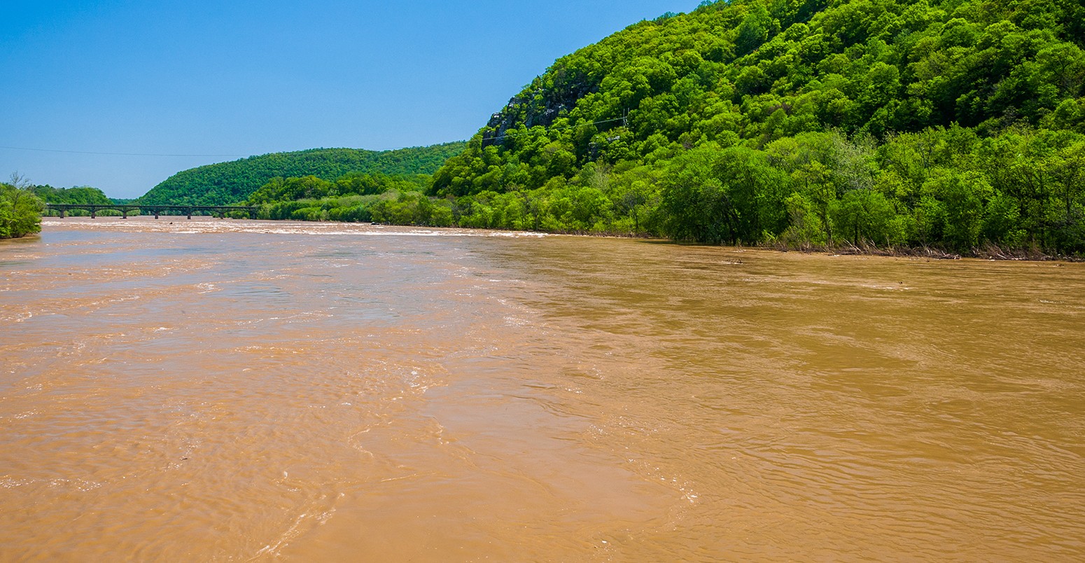
Main image: Spring flooding on the Potomac River in Harper’s Ferry, West Virginia.
Mallakpour, I. and Villarini, G. (2015) The changing nature of flooding across the central United States, Nature Climate Change, doi:10.1038/nclimate2516