Map: Where climate change could hit electricity production
Robert McSweeney
01.04.16Robert McSweeney
04.01.2016 | 4:54pmResearch out today maps where power plants around the world are most at risk from higher water temperatures and decreased water availability.
The paper, published in Nature Climate Change, extends earlier work on how a changing climate could affect the amount of electricity power stations in the US and Europe are able to generate. The new study covers 1,400 traditional power plants and almost 25,000 hydropower systems, representing 28% and 78% of global capacity, respectively.
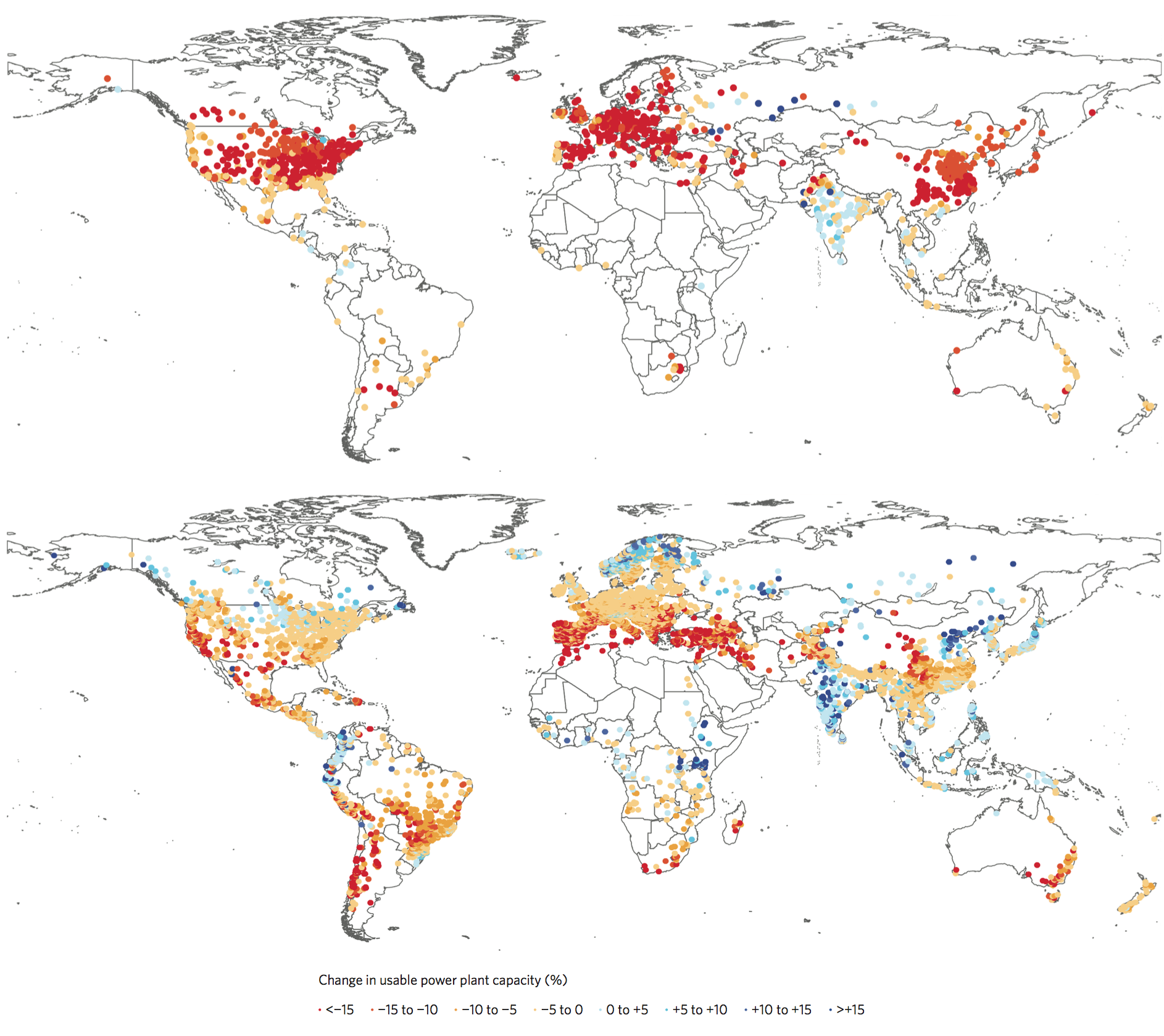
The maps below shows how “usable capacity” – i.e. how much electricity a power plant can produce – is likely to be affected by the 2050s if global greenhouse gas emissions remain high. The upper map shows traditional power stations and the lower map shows hydropower. The red and orange dots show where capacity is projected to drop, while blue dots show where it could increase.
The study estimates decreases in usable capacity for 81-86% of traditional power stations and 61-74% of hydropower plants worldwide by the middle of the century, with average annual reductions in power of 7-12% and 1-4%, respectively. The results also suggest that maximum monthly reductions in capacity could reach over 30%. The ranges in these figures cover scenarios of low and high levels of greenhouse gases in future.

Impacts of climate and water resources change on annual average usable capacity of existing traditional power stations (upper map) and hydropower plants (lower map). Results are for the 2050s (2040-69), under a high emissions scenario (RCP8.5) and relative to 1971-2000. Source: van Vliet et al. (2016).
So how might climate change affect electricity generation?
Around 80% of the world’s electricity is produced by traditional power plants that convert heat – generated from nuclear reactors or burning fossil fuels and biomass – into electricity. A further 17% comes from hydropower systems.
Both rely heavily on water. Hydropower uses it directly to turn turbines and generate electricity, while traditional power plants use water predominantly for cooling. And they use a lot of it too – approximately half of all the water taken from rivers and lakes every year in England and Wales, for example.
But changes in water availability and higher water temperatures are likely to affect how much water can be used by power plants and how effective it is at cooling, the researchers say. In the paper you can find some handy maps of how river flows and water temperatures are projected to change across the world.
The collection of maps highlight where current power stations are most vulnerable, says lead author Dr Michelle van Vliet, a researcher at the International Institute for Applied Systems Analysis (IIASA), in a press release:
In particular the US, southern South America, southern Africa, central and southern Europe, Southeast Asia and southern Australia are vulnerable regions, because declines in mean annual streamflow are projected combined with strong increases in water temperature under changing climate.
There are adaptation options that could help limit these impacts, the study says, such as improving the efficiency of power plants, using seawater rather than freshwater for cooling, and adopting more efficient cooling systems that recirculate water.
But given that power plants tend to be in operation for many decades, these options need to be considered now, says co-author Prof Keywan Riahi, Energy Program Director at IIASA. He tells Carbon Brief:
Otherwise climate change will add significant costs to electricity bills and make supply less reliable – i.e. the risk of shortages will increase in the future.
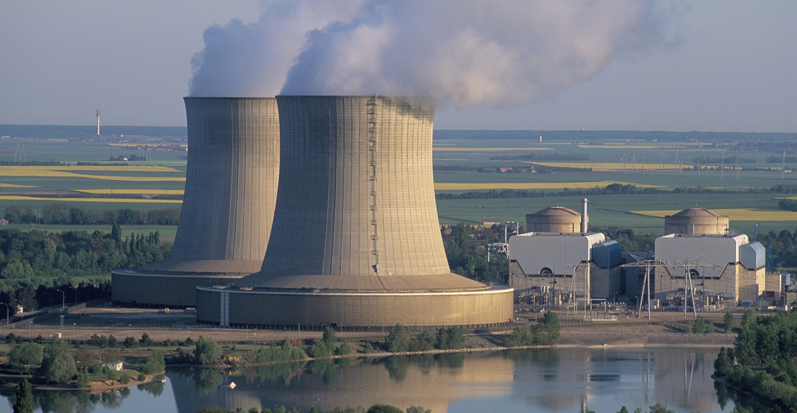
Main image: Nuclear power station in St.-Laurent-des-Eaux, France. © Bruno Barbier/robertharding/Corbis.
van Vliet, M. T. H. et al. (2016) Power-generation system vulnerability and adaptation to changes in climate and water resources, Nature Climate Change, doi:10.1038/nclimate2903.
-
Map: Where climate change could hit electricity production
-
Map: Where will global electricity production be affected by higher water temperatures and decreased water availability from a changing climate?

