Guest post: Untangling fact from fiction in media warnings of extreme weather

Andrew Barrett
01.14.16Andrew Barrett
14.01.2016 | 11:34amDr Andrew Barrett is a researcher in the Department of Meteorology at the University of Reading. His work focuses on the physical mechanisms behind why we get heavy and localised rain, which has been the cause of recent flooding events in the UK.
Weather is a national obsession here in the UK, and it’s something newspapers frequently tap into.
It is not unusual to see predictions for exceptionally cold winters, hot summers, extreme storms and flooding splashed across the front pages.
But these headlines are often exaggerated and, coupled with confusion or corruption of meteorological terms, it is hurting the reputation of meteorology and the trust of the public.
Most importantly, it is making the communication of severe weather warnings more challenging.
Telling ‘weatherbombs’ from windstorms
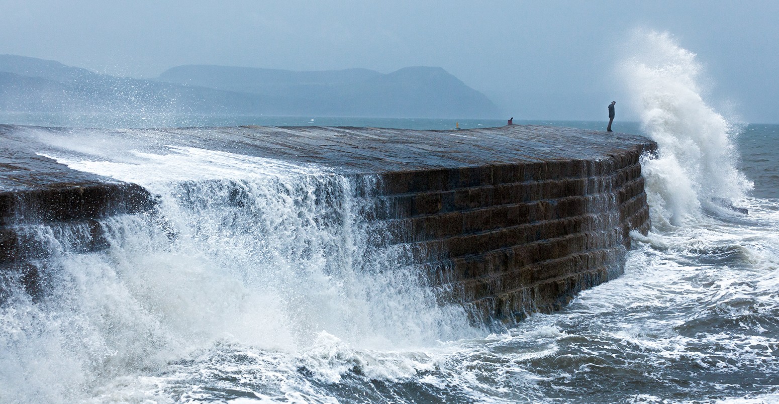
With the recent flooding across many parts of the UK, we have had a strong reminder of the need to clearly and accurately communicate weather warnings to those at risk. The media play an important part in this, but hype and exaggeration is a constant frustration.
For example, the media will sometimes warn us of an approaching hurricane – something the UK has, in fact, never experienced. That’s because a “hurricane” is something very specific – a storm associated with large volumes of rain that forms over warm, tropical oceans. The UK media often use the term “hurricane” as a synonym for windstorm, which is a very different meteorological feature that the UK certainly does see its fair share of.
The confusion between hurricanes and windstorms has been further complicated by the fact the Met Office are now naming UK winter storms, something previously only associated with hurricanes.
Similarly, “monsoon” is sometimes used as a synonym for extremely heavy rainfall, whereas a monsoon is actually a seasonal shift in the wind. In some parts of the world, a monsoon does lead to months of heavy rain. In others, it does not.
Every winter, we see headlines about the “coldest winter for 100 years”, “100 days of snow”, “weatherbombs”, “snowbombs” and “mini-tornadoes”, all of which add to the general mixing pot of confusion over weather forecasting.
A very recent example is a Daily Express headline yesterday, which warned:
Snowbomb bringing -15C freeze could cause increased deaths as elderly urged to keep warm.
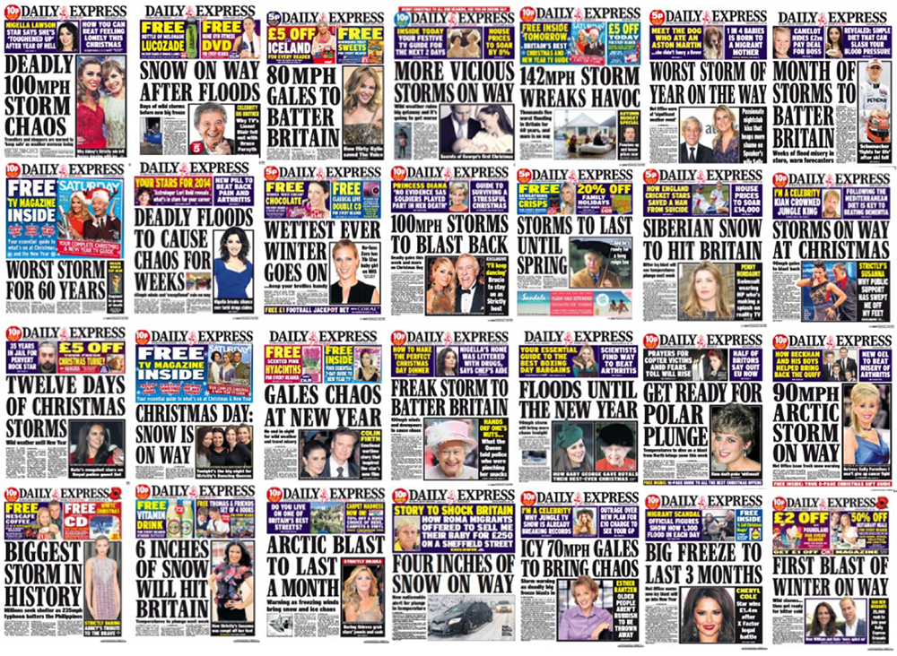
Daily Express front pages in the three-month period between November 2013 and January 2014.
Probable cause
The weather, as we are all well aware, is challenging to predict.
In recent decades, scientists’ ability to make accurate forecasts has improved markedly. Whereas centres such as the UK’s Met Office were hard-pushed to forecast the Great Storm of 1987 even 12 hours before it happened, we now commonly have forecasts and warnings of approaching storms several days ahead (e.g. winter 2013-14). This improvement comes from a combination of years of scientific research, modern supercomputers and extra weather observations from satellites.
To many, one of the more surprising facts about weather forecasting is that our ability to predict the weather accurately varies from one day to the next. Some days, forecasters can be very confident of what will happen. Other days there may be two, three or more options for the path a storm will take, or how much rain a weather front will produce.
One of the biggest steps forward in weather forecasting recently has been our ability to quantify this uncertainty through “probabilistic” forecasting. That means expressing how likely it is that a specific event will happen, rather than trying to be definitive about whether it will or it won’t. An example would be saying there’s an “80% chance of rain tomorrow” rather than it will rain tomorrow.
How do we do this? The first step is understanding that the atmosphere is chaotic, which means small disturbances in the atmosphere now can grow to become very large disturbances in a day or two. This is the so-called Butterfly Effect. It means that a single weather forecast made today could be quite wrong in a few days.
Since we cannot know the exact state of the atmosphere at any given time, we run numerous weather simulations, each using a slightly different estimate. These simulations are known collectively as an “ensemble”.
If all the forecasts from an ensemble agree, forecasters can be confident of the forecast accuracy. If they do not agree, we know to be more cautious. We have to weigh up the potential risk of an extreme storm against the probability of it happening.
Although complex, probabilistic forecasts are the most accurate forecasts available. It really does rain on 8 out of 10 days when the chance of rain is 80%. Anyone who predicts with certainty that it will or won’t rain tomorrow is overconfident and, therefore, misleading you.
Here are some important questions you could ask yourself when reading a weather news story, to know whether or not you can trust it:
Who has produced this forecast/warning? Is it a national meteorological agency (eg. the Met Office), another government body (eg. the Environment Agency), an established private company, or someone you’ve never heard of before?
Why have they publicised their forecast? Is it to warn the public, save lives and property? Or to get their name into the spotlight?
Where have they publicised the forecast? Is this forecast from a trustworthy source, such as a major broadcaster, on the website of a government body, or a reliable newspaper?
Are the claims believable? Forecasting is challenging and reliable sources will rarely predict the hottest/driest/coldest/wettest season on record for fear of the backlash. Just look at the reaction to the Met Office’s so-called “Barbeque Summer” prediction of 2009. In reality, all the Met Office predicted was that the summer was likely to be warmer and drier than average, certainly not the hottest nor the driest. Similarly, forecasts for a specific day are rarely accurate if done more than a week in advance. Forecasts predicting the weather for your wedding day in six months’ time should be treated with extreme caution.
Next time you’re wondering if the weather is likely to change, think critically about the stories and claims you see. You can also test yourself with our BuzzFeed quiz, launched today by a network of early career researchers called the Voice of Young Science. The quiz aims to help readers determine genuine from exaggerated weather stories, and real meteorological terminology from words that are frequently misused. It might not be as easy as you think.
-
Guest post: Untangling fact from fiction in media warnings of extreme weather
-
Which of these is a real weather term? Willy-willy. Chinny-chinny. Dusty-dusty. Find out more in our latest extreme weather guest post.