Guest post: Vast carbon store found under Congo swamp forest

Prof Simon Lewis
01.13.17Prof Simon Lewis
13.01.2017 | 2:33pmA guest article by Prof Simon Lewis, professor of global change science at University College London and the University of Leeds.
In the middle of the Congo Basin in central Africa is a low-lying area known as the Cuvette Centrale. It is home to the world’s second largest tropical wetland, after the Pantanal in Brazil.
This week, in Nature, my colleagues and I published scientific evidence that beneath this swamp forest lies a thick layer of peat, which until now has gone undetected.
We estimate that the carbon content of this peatland is about equivalent to 20 years of the current fossil fuel emissions of the US.
Soil carbon
Peat is an organic wetland soil made of partially decomposed plant debris. It is usually found in cooler environments where plants decompose relatively slowly. Where this decomposition is further slowed by waterlogging, a layer of peat can build up. This gradual process removes CO2 from the atmosphere, locking up carbon in the thick, boggy soil.
The amount of carbon stored in peat is large. Peat covers just 3% of Earth’s land surface, but stores one-third of the world’s soil carbon – about 500-600bn tonnes.
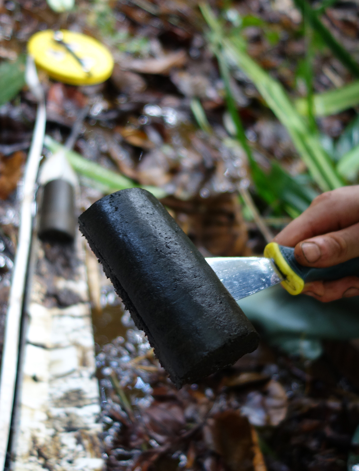
Sample of peat from the Congo basin peatland. Credit: Simon Lewis.
Peat soils are susceptible to climatic changes if they cause the peat to dry out, which starts the decomposition process again, releasing the stored carbon back into the atmosphere. Protecting peat soils – along with other ecosystems that store carbon – is an important part of the global effort to cut carbon emissions. And the first step in peatland protection is knowing where they are.
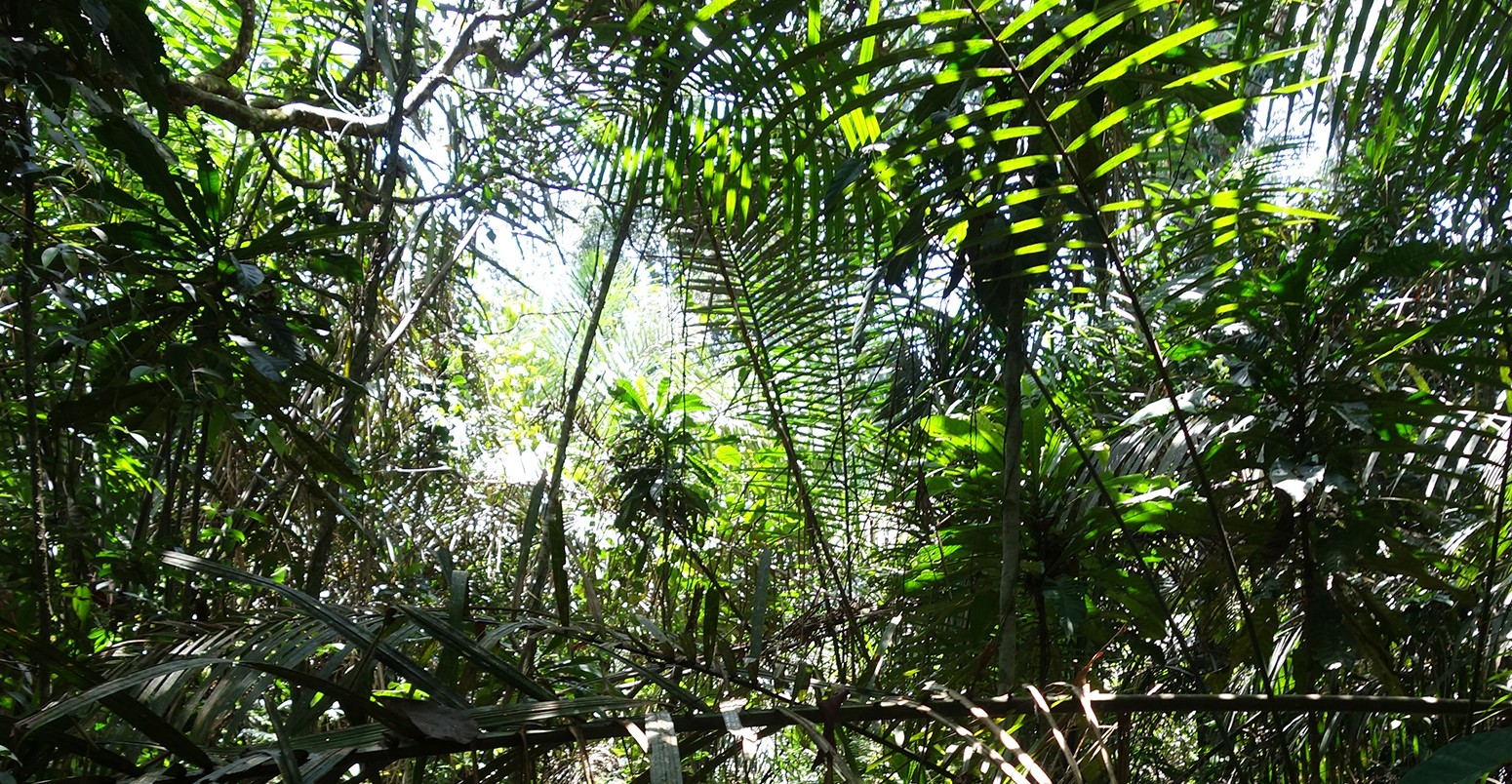
Swamp forests
In the high temperatures of the tropics, peat soils are less common as plants decompose quickly. However, in areas that are waterlogged year-round, and where nutrient levels in the water are low, decomposition can be slowed enough to allow peat to form under swamp forest.
Large peat swamp forests are well known on the southeast Asian islands of Borneo and Sumatra (pdf), and similar peat forests have been recently been found in Western Amazonia. I had a hunch that the vast Cuvette Centrale wetland might hold a treasure trove of peat.
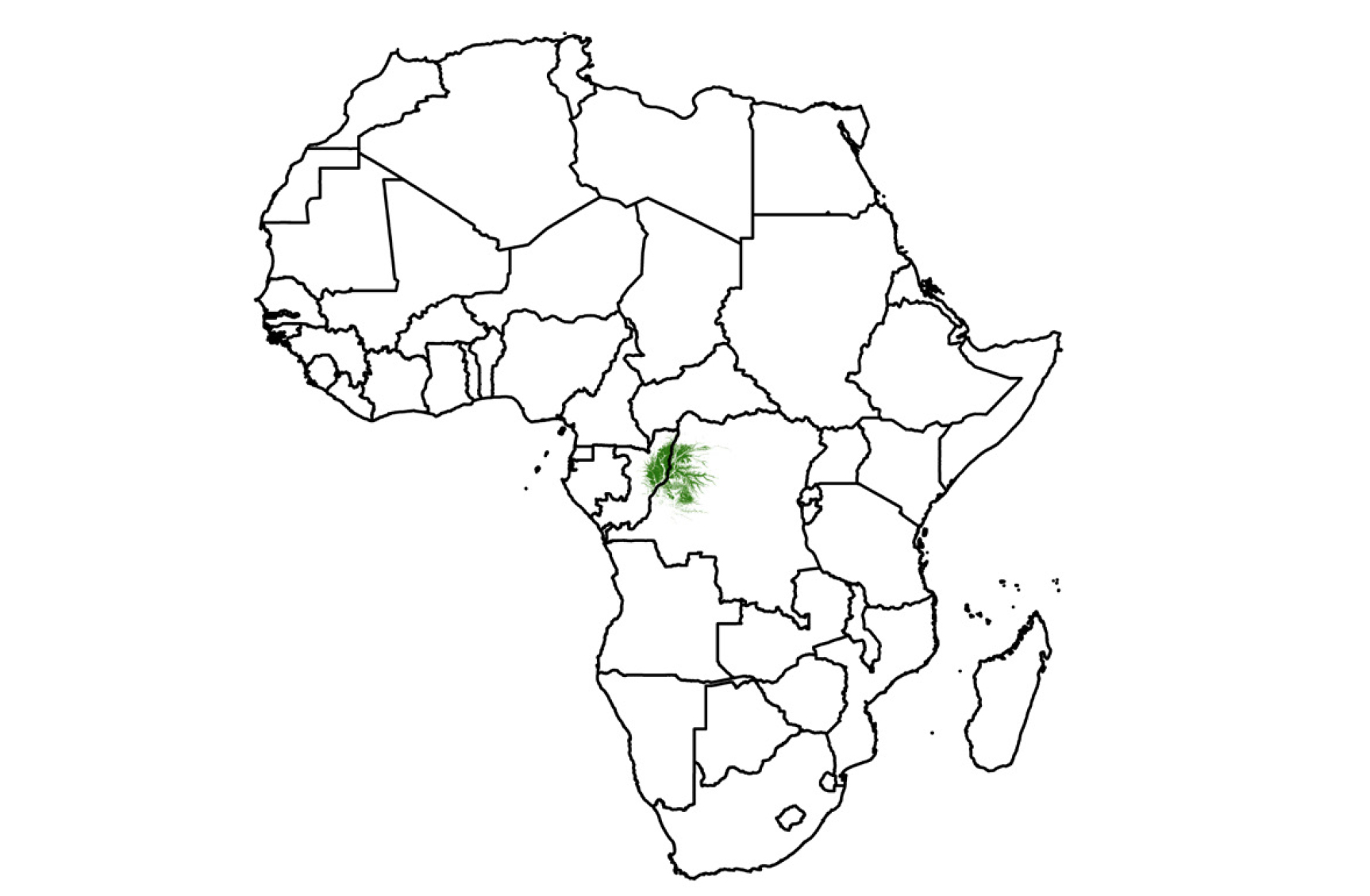
Fig 1a. Location of the Cuvette Centrale wetlands in Africa (in green)
However, there wasn’t much solid information to go on. My colleagues and I found nothing in the scientific literature, but a few obscure reports did mention that there was peat in the Congo Basin. Unfortunately, these were passing comments, without grid-references, or the names of nearby villages or rivers to locate and verify the existence of peat, its depth or carbon content.
Satellites cannot detect peat, but they can point to swampy forested areas that could be hiding peat. In 2012, using radar and optical satellite data our search took us to the swamps of northern Republic of the Congo, where – with our Congolese partners – we first discovered evidence of peat.
This gave us some data to go on. We now knew we could identify potential areas of peat from the satellite data. Next we had to optimise our search and test our hypotheses of where we should, and shouldn’t, find peat.
Trekking across the Congo
The fieldwork wasn’t easy going. Sampling soils in the swamp is challenging – camping on dry land and then trekking in each day to collect samples. Initially, we had hardly explored the area, and the depth of peat was often shallow – often about one metre deep.
Led by the paper’s lead author, Greta Dargie, whose PhD thesis I was supervising, the team roamed 40,000 square kilometres of northern Republic of the Congo. Learning from the local villagers who hosted our fieldwork, we left dry land and camped in the swamp. In 2014, we trekked to the mid-point between the two major rivers of our region, the Oubangi and the Likouala-aux-herbes, a vast expanse of swamp, sampling peat every 250 metres for 30 kilometres. We found ever-deeper peat, to a maximum depth of 5.9 metres.
We now knew for certain that the huge shallow basins between the big rivers were indeed a continuous layer of peat that reached considerable depths.
Radiocarbon dating of the peat told us the oldest was 10,600 years old. This meant that it formed just after the last ice age ended. With the Earth getting warmer, central Africa got wetter, filling these shallow basins with water and allowing peat to form.
Sensors monitoring the level of the water table in the swamp also told us that the peatland is not sustained by rivers flooding their banks. Instead, the peatlands appear to be at the mercy of whatever rain falls.
After collecting data from hundreds of locations, we finally understood the characteristics of the land, vegetation and the peat. Our findings showed that only two vegetation types have peat underneath: year-round waterlogged swamp forest of hardwood trees, and year-round waterlogged swamp forest dominated by a single species of palm tree.
Using satellite data, we mapped these forest types across the whole region to determine the boundaries of the Congo Basin peatlands. You can see these in the map below. The coloured shading shows the likelihood of finding that type of vegetation in that location.
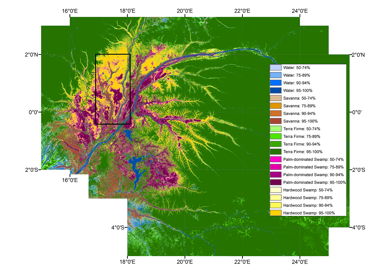
Dargie Fig1c. Map of the composition of peatland in the Congo.
We found that peat covers an astonishing 145,500 square kilometres of land in the region. Overall, the Cuvette Centrale wetlands occupy about 10% of the Congo Basin. We now know that about 40% of the total extent of all the Cuvette Centrale wetlands has peat underneath.
Climate change
In terms of carbon, combining this area with our peat depth and peat carbon content measurements from the laboratory, we estimate that Cuvette Centrale’s peat holds 30.6bn tonnes of carbon. The area is exceptionally carbon-rich.
Put another way, while the peat covers only 4% of the whole Congo Basin, it stores below ground roughly the same amount of carbon stored above ground by the trees that cover the other 96%.
But is this carbon vulnerable? Fortunately, the area is not currently threatened with drainage for industrial agriculture – the fate of many peatlands in southeast Asia. But oil companies are focusing in on the last remaining areas of Earth to explore for fossil fuels.
In terms of climate change, the peatlands are rainfed, so reductions in rainfall or an increase in evaporation from higher temperatures could reduce waterlogging. This could then allow the peat to decompose and release its carbon.
Predicting whether the 30bn tonnes of carbon in the central Congo peatlands will remain out of the atmosphere due to climate impacts is difficult. Few weather stations exist in the region, the central Congo area has been neglected by modellers, and climate projections for rainfall are not consistent.
But our new discovery will hopefully lead to significant scientific investments in the region. This will allow us to make better estimates of the carbon stocks, understand how vulnerable the peatland is to rainfall any future reduction in rainfall, and what those rainfall patterns are likely to be in a warmer world this century.
This guest article is based on the following journal paper: Dargie, G. C. et al. (2017) Age, extent and carbon storage of the central Congo Basin peatland complex, Nature, doi:10.1038/nature21048