Video: Visualising methane emissions as they happen
Robert McSweeney
11.30.15Robert McSweeney
30.11.2015 | 4:00pmResearchers have developed a technique to film methane – a powerful greenhouse gas – as it’s released into the atmosphere. The approach uses infrared imaging, turning something that is usually beyond the capability of the human eye into video clips where methane is easily distinguishable.
The new approach can help overcome some of the challenges in traditional ways of monitoring methane emissions, the researchers say.
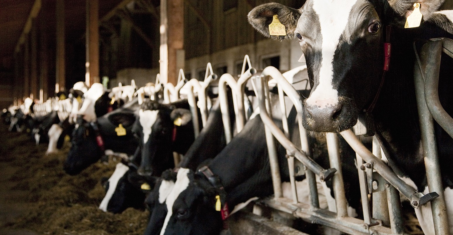
You can see the technique in action in the (slightly grainy) clip below. The purple and green colours show methane escaping from a vent on the side of a barn. The barn in question is housing 18 individual prolific producers of methane – otherwise known as a small herd of cows.
Visualisation of methane emissions (shown in purple and green) from vent in barn of cows. Source: Gålfalk et al. (2015)
With around 25 times the heat trapping power of carbon dioxide, methane is a greenhouse gas that packs quite a punch. It is produced and emitted to the atmosphere from a number of natural sources, such as wetlands, as well as from human activities, including fossil fuel combustion, landfill sites, rice paddies, and keeping livestock.
Methods of measuring methane emissions range from the small-scale – using methane chambers – all the way up to satellites. Both have their drawbacks. Methane chambers are small boxes that are placed on the ground to measure how much methane is being released. But they only cover only a small area (up to a square metre, for example), so scientists have to take lots of measurements to analyse an entire landscape. Satellite measurements can cover huge areas, but can’t pick out specific points where the methane is coming from.
Scientists have also started using drones to measure methane emissions, as you can watch in this BBC News clip from a landfill site last week.
The imaging technique, described in a paper in Nature Climate Change, opens up a new opportunity to overcome some of these limitations. Lead author Dr Magnus Gålfalk, a senior lecturer at Linköping University in Sweden, tells Carbon Brief:
It is an efficient way to pinpoint sources of methane emission, as a whole region is imaged at the same time, with high spatial resolution.
Measurements can be made from the ground or from several hundred metres in the air using a helicopter, the paper says.
Understanding exactly how methane gets from where it’s produced to the atmosphere is crucial to being able to model it accurately in computer simulations, says Dr Vincent Gauci, a senior lecturer in earth systems and ecosystem science at the Open University. He tells Carbon Brief:
It’s vital that we understand the sources of methane and how those source respond to change.
Gauci wasn’t involved in the study, but as he leads the Methane Network on behalf of the Natural Environmental Resource Council, he is very excited at the possibilities that methane imaging offers:
Critically, more than just seeing it, they’re able to quantify it, which is really rather cool.
The video below shows another visualisation of methane emissions – this time simply from a controlled gas release in front of the researchers’ lab.
Visualisation of controlled release of methane (shown in purple) on the lawn outside laboratory. Source: Gålfalk et al. (2015)
Gålfalk, M. et al. (2015) Making methane visible, Nature Climate Change, doi:10.1038/nclimate2877